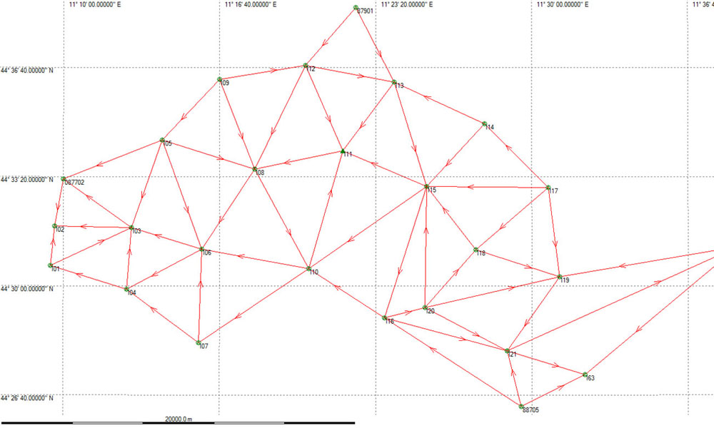
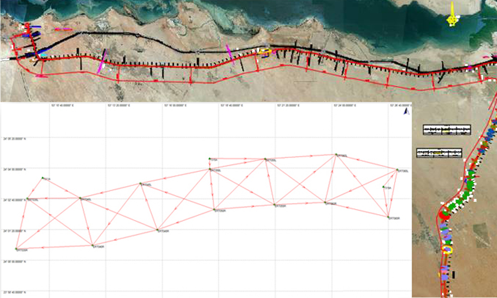
- Planning and satellite measurement of geodetic and topographic networks.
- Homogeneity inspections and enhancing of authorized networks (I.G.M. and Land Registry).
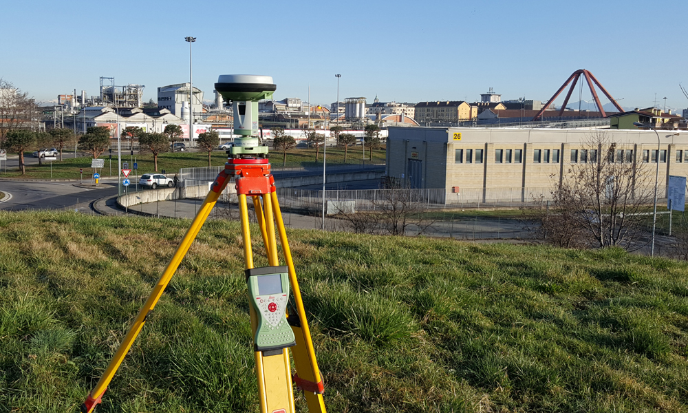
- Static or RTK mode surveys with various scale.
- Photographic model networks.
- Network testing.
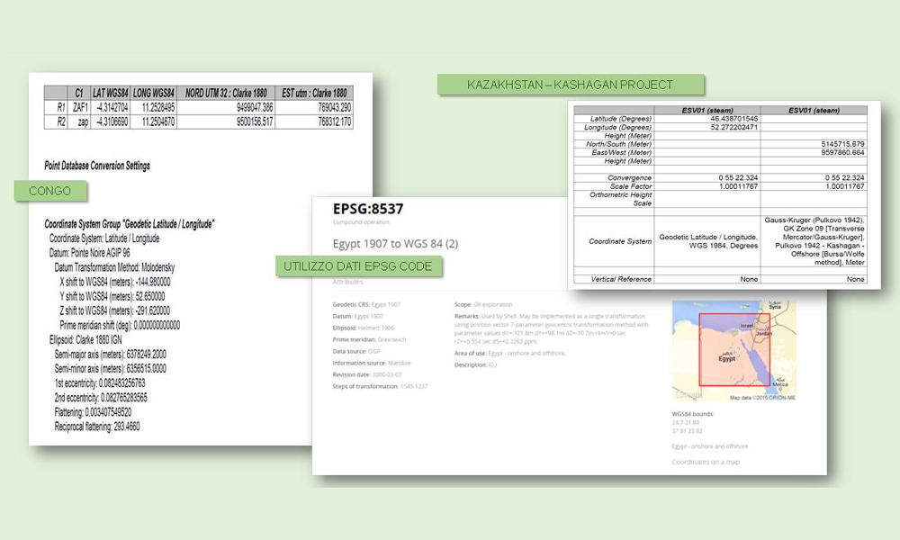
- Geodetic computations and data processing.